A View of Planet Earth With Summer - Page 4
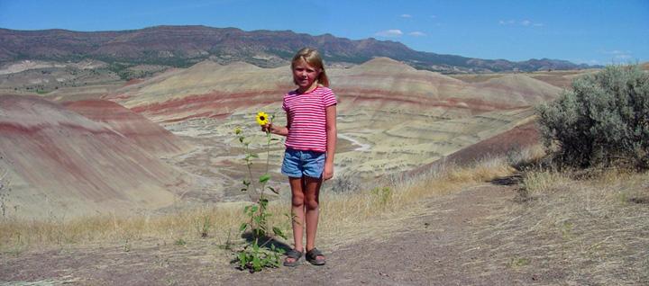
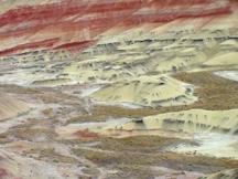
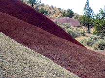
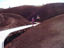
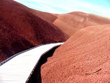
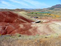
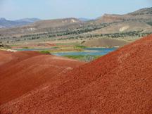
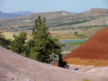
The Painted Hills Unit of the John Day Fossil Beds is a wonderful place to survey the colors of nature, and it's a photographers dream with so many picture opportunities.
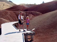
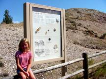
In the picture above, Summer is sitting next to a sign that explains about the significance of the small hill (Leaf Hill) just behind her. It is here where massive amounts of fossilized plants and leaf fossils have been found. The hill is made up of deposits that were once at the bottom of a lake, but which are now exposed and providing a record of a changing deciduous forest community from ancient times. The hill has provided scientists with much of their knowledge about Oregon's ancient forests, about 35 species so far. Fossils are still recovered in this area, but fossil hunting and walking on the hill is strictly prohibited except to those who are permitted to do research. We hiked the trail that winds around the hill through a scattering of juniper trees.
 |
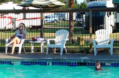 |
Our visit to the Painted Hills ended our exploration of the John Day Fossil Beds National Monument and it was time to find and learn other things about our planet earth. So, we left the town of Fossil, Oregon and headed southwest and ended up at the Cascade Meadows RV Resort near LaPine, Oregon where Summer was able to take a refreshing swim in a pool. This was a nice relief to the warm weather we were having.
We were now in an area which had once experienced much volcanic activity (as recently as 1,300 years ago). The Newberry National Volcanic Monument was just a few miles away and we were based on the western lower flank of Newberry Volcano, although most people who pass by here have no idea they are actually next to or on a very large volcanic feature. This is not a high and lofty composite volcano such as the mighty Mount Rainer, instead it is an immensely spread out shield volcano whose base is 25 by 65 miles in diameter, covering about 500 square miles. Its summit crater is a collapsed caldera about 3 by 4 miles wide with two good-sized lakes in the middle of it (Paulina Lake and East Lake). A central pumice cone is located between the two lakes, and up to 400 small cinder cones flank the volcano for many miles around it. We would make our base camp here for the next three days and take some excursions to see what we could learn about this area.
 |
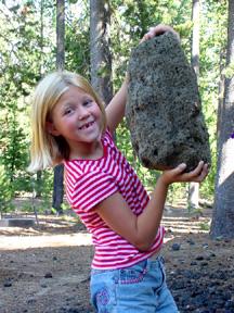 |
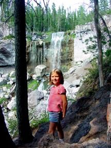
Our first excursion was to Paulina Falls where Paulina Lake drains over the western edge of the caldera. This is a beautiful area with tall pine trees and trails that take you both above and below the falls. Next, we drove up to Paulina Lake and took a look at the resort facilities located there, and then stopped at an information center where Summer was able to make a close up inspection of a 3 foot lava bomb and a similar sized boulder of obsidian; two relics of volcano building. Then she was able to try her strength at lifting some large rocks of pumice, which she was able to accomplish without much trouble. When she attempted to lift some other similar sized rocks, they would not budge from the ground. She learned that not all rocks are created equal, and she did figure out why she was able to lift the big pumice rock.
 |
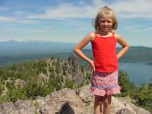
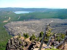
Our next excursion was to the top of Paulina Peak on the south rim of the caldera and the highest point on the volcano. At 7,985 feet, it's not the highest mountain in Oregon, but you can drive to the top and it is reported to have the highest toilet facilities in the state. The view from the top is quite spectacular and you can see northward to Mount Adams in Washington State and south to Mount Shasta in California. Down below in the caldera, you can see the two shining blue lakes (which are said to have the best fishing in the state), and the big obsidian lava flow on the southeast rim that stretches out toward the two lakes.